
AI powered road network extraction and resilience analysis for Indian cities. Satellite imagery is used to detect roads (including roads hidden under trees, shadows, or buildings), reconstruct a connected road network, and simulate the impact of road closures for disaster and traffic planning.
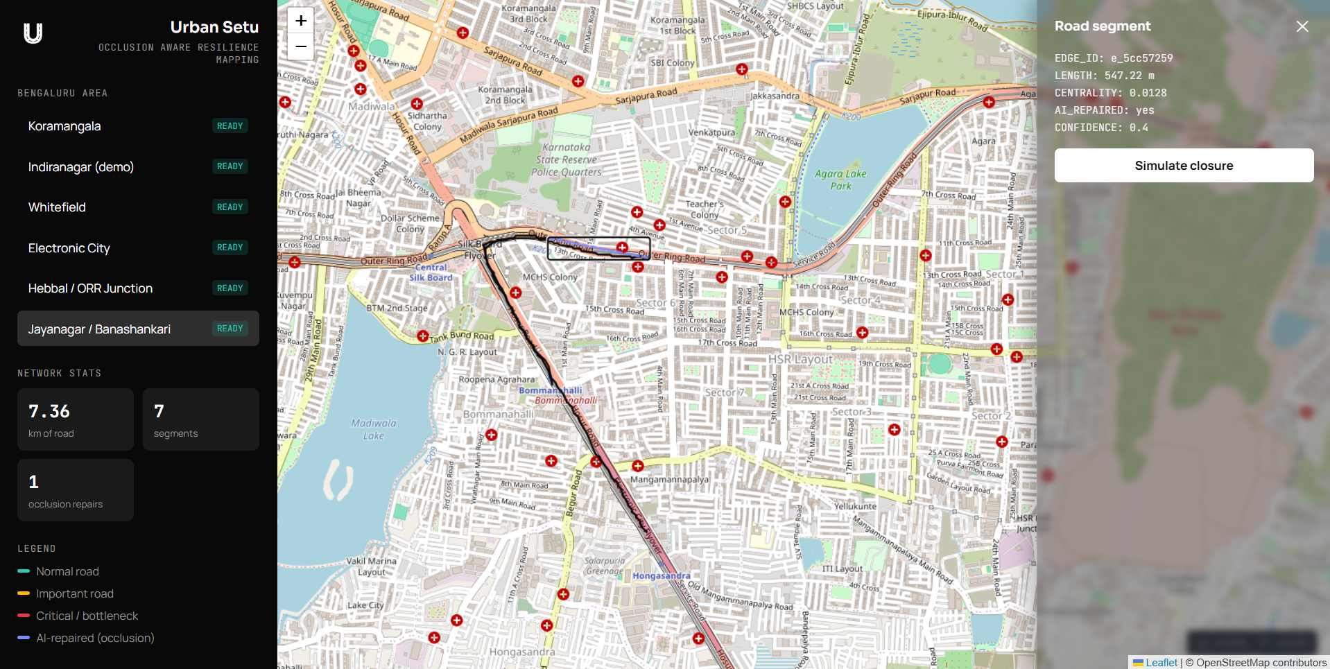
The project has three independent services:
FastAPI_Server/— Python service that runs the segmentation model and builds the road network graph from a satellite GeoTIFF.Node_Server/— Express backend that orchestrates requests, caches processed results, and runs road-closure simulations.Frontend/— React + Leaflet dashboard for viewing the road network and running simulations.
Areas already pre-processed and included in Node_Server/db/regions.json:
Koramangala, Indiranagar / MG Road, Whitefield, Electronic City,
Hebbal / ORR Junction, Jayanagar / Banashankari.
- Python 3.10+
- Node.js 18+
- npm
This file is not included in the repository because of its size. It is
required for FastAPI_Server to run.
Download link: best_unetplusplus_b4.pkl
After downloading, place the file directly inside the FastAPI_Server/
folder, at the same level as app.py:
FastAPI_Server/
  app.py
  requirements.txt
  best_unetplusplus_b4.pkl   <- place it here
cd FastAPI_Server
python -m venv venv
source venv/bin/activate        # Windows: venv\Scripts\activate
pip install -r requirements.txt
uvicorn app:app --reload --port 8000
Verify it is running by opening http://localhost:8000 in a browser. You
should see a JSON message confirming the API is up.
cd Node_Server
npm install
cp .env.example .env
npm run dev
Verify it is running by opening http://localhost:4000 in a browser.
The .env file should contain:
PORT=4000
FASTAPI_URL=http://127.0.0.1:8000
Since the pre-processed areas are already saved in db/regions.json, the
dashboard will work even without FastAPI_Server running. FastAPI_Server is
only needed if you want to process a new area.
To process a new area:
curl -X POST http://localhost:4000/api/analyze \
  -F "file=@/path/to/image.tiff" \
-F "regionId=your_region_id"cd Frontend
npm install
cp .env.example .env
npm run devThe .env file should contain:
VITE_API_URL=http://localhost:4000
Open http://localhost:5173 in a browser. Select an area marked READY from
the left panel to load its road network. Click on any road segment to view
its details and simulate closing it.
Start the services in this order:
- Node_Server
- Frontend
- FastAPI_Server (only if processing a new area)
Since region data is already cached, FastAPI_Server does not need to be running just to view the dashboard.
Satellite imagery used for this project is sourced from the Copernicus Browser (Sentinel-2, 10m resolution): https://browser.dataspace.copernicus.eu/
A sample GeoTIFF (cropped to one of the test areas) is provided for testing the FastAPI_Server pipeline without needing to download imagery yourself:
Sample GeoTIFF link: Bengaluru Sentinel-2 GeoTIFF Images